
Read: William Blake vs the World by John Higgs ★★★☆☆ 📚
Years ago I enjoyed the songs & Marriage of Heaven and Hell, I was baffled by Blake’s prophetic books. Light is shone on this personal mythology. Amusing links to how Blake is used now, e.g. Jerusalem.
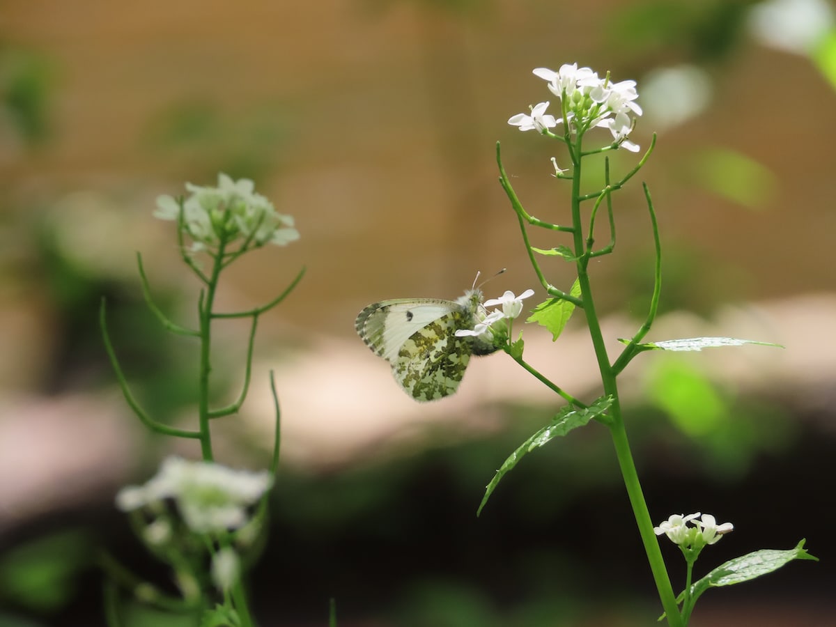
Female Orange Tip Butterfly
At the same time, during both World War One and World War Two, there were concerted efforts to feed people. It started with centrally cooked meals that people took home to eat, but soon blossomed into a far-reaching network of government-run restaurants.
Another really interesting episode from Jeremy Cherfas. I’d never heard of the British Restaurants that were more common in the midst of WW2 than MacDonalds are now. Where they came from, what happened in different places and the possibility of a return were all covered.
Liked: The Verb – The Sound Designed Verb
Ian McMillan celebrates spectral spaces, the pulse of the body, and the power of repetition, in a Verb which showcases emerging talent – new sound designers from the Sound First scheme ….
Ian is joined by the songwriter, producer and sound designer Benbrick, the poet, playwright and performer Hannah Silva, and Sound First participant Noah Lawson, to explore what sound design can bring to poems, and what sounds are buried in poems themselves.
Really enjoyed listening to this, perhaps I am a wee bit more tuned into sound after Sunday.
Dawn this morn, REVEIL 2023 streaming
The above is a short selection of a few moments of the stream I broadcast this morning, 10 minutes in total. The segments are each separated by 1 seconds of generated silence. The Whole thing is on the Stream Page. There is a fox barking near the start and a pigeon claps its wings over head near the end.
I just updated the twitter category on this blog to be called posse as it is syndicated to twitter & mastodon. I also disabled the twitter cross posting from micro.blog. Micro.blog does a lovely job of cross posting images along with alt tags to mastodon.
@magsamond enjoying skimming your theses.
Desire Lines in Open Space:: An Exploration of the TeachMeet Phenomenon
“Desire Lines” and “Open Spaces” are important concepts.
 #SilentSunday
Joining the #stream for the annual celebration of Dawn Chorus Day. Organized by @soundtent ‘Reveil travels West on live audio feeds from streamers around the world at daybreak.’ I ‘m at
http://locus.creacast.com:9001/GlasgowWest
HikeTracker
I’ve been looking for a replacement for Trails .
There are quite a lot of GPX apps out there so it has been interesting looking at them.
Many ‘hiking’ apps are concerned with giving you routes or posting routes you take their own or other services. These apps tend to be quite fully featured and often need an account on an online service. Trying a few out gave me a chance to think of what I wanted.
- Easy recording of a trail
- Trail shown live on a map, preferably OpenStreeMap.
- Quick and simple transfer of gpx track to my mac so that I can use it to tag photos, etc.
- Not completely killing the battery of my aging iPhone over a day.
Other features are either a bonus (some stats) or a complication (online services).
I’ve settled, for now at least, on HikeTracker . The app has been designed by a hiker, with the main aim of accuracy & simplicity. It fulfils all of my requirements.
The app is set up to work well “out of the box” for a hiker or walker – just tap “Start” and go!
It has worked well for me in a couple of tests, geotagging some rather blurry photos and giving me a track to add to the map.
I was happy to pay for trails and would be happy to pay for this free app too.
Featured image: Screenshots of HikeTracker, map on the left, stats on the right.