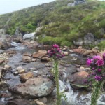
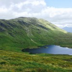
A few years ago1 I tested the WP OSM plugin. I didn’t get it to do exactly what I wanted so left it on the back burner. In the mean time I made a map system of my own. The plugin had been producing some security warnings from Jetpack and I’d deactivated it. Last week I saw some fixes and through I’d try it again. Using the gpx file I recorded last week and the associated flickr album2 I had another go.
I created the kml file with gvellut/flickr2kml, which is a command line app, to convert a flickr album url to a kml file with images. The map above combines the gpx track & kml file.
The result is not, so far, exactly what I hoped. I was thinking the images could be views at a larger size, or link to the bigger versions. I suspect I could use the flickr2kml templates to do that.
I am also wondering if I could overlay and overlap bigger versions of the images with some random transparency maybe something like this, but with some randomness:
A few things to think about.
- 9 years ago, not sure where the time goes! ↩︎
- I used this in my own system: 2024-09-27 Finlas Loop ↩︎


