The shortcode I am using looks ok to me and the photos are geotagged. I added a fullsized one because the thumbnails are stripped of geo-tags. So I expected the one big photo to show up at least….
Yest another mapping/iphone post. This might not seem like education but I consider the mapping of walks etc. a sort of trial for possible Teaching and learning activities. At Sandaig I was always interested in blogging trips (Sandaig Netherlands 2008 or Glencoe 06 for example). I am interested in trying to get pupils and groups to tell stories in different ways, audio, text, pictures and video adding location into the mix seems like a good idea. This week i was talking to some of the instructors at Kilbowie Residential Outdoor Centre Oban discussing some of the potential for adding some more ict into their mix through Glow.
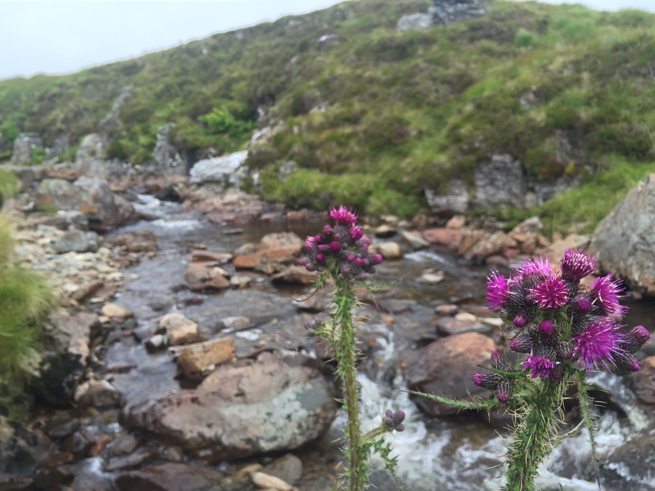
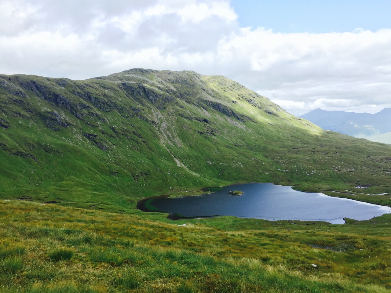
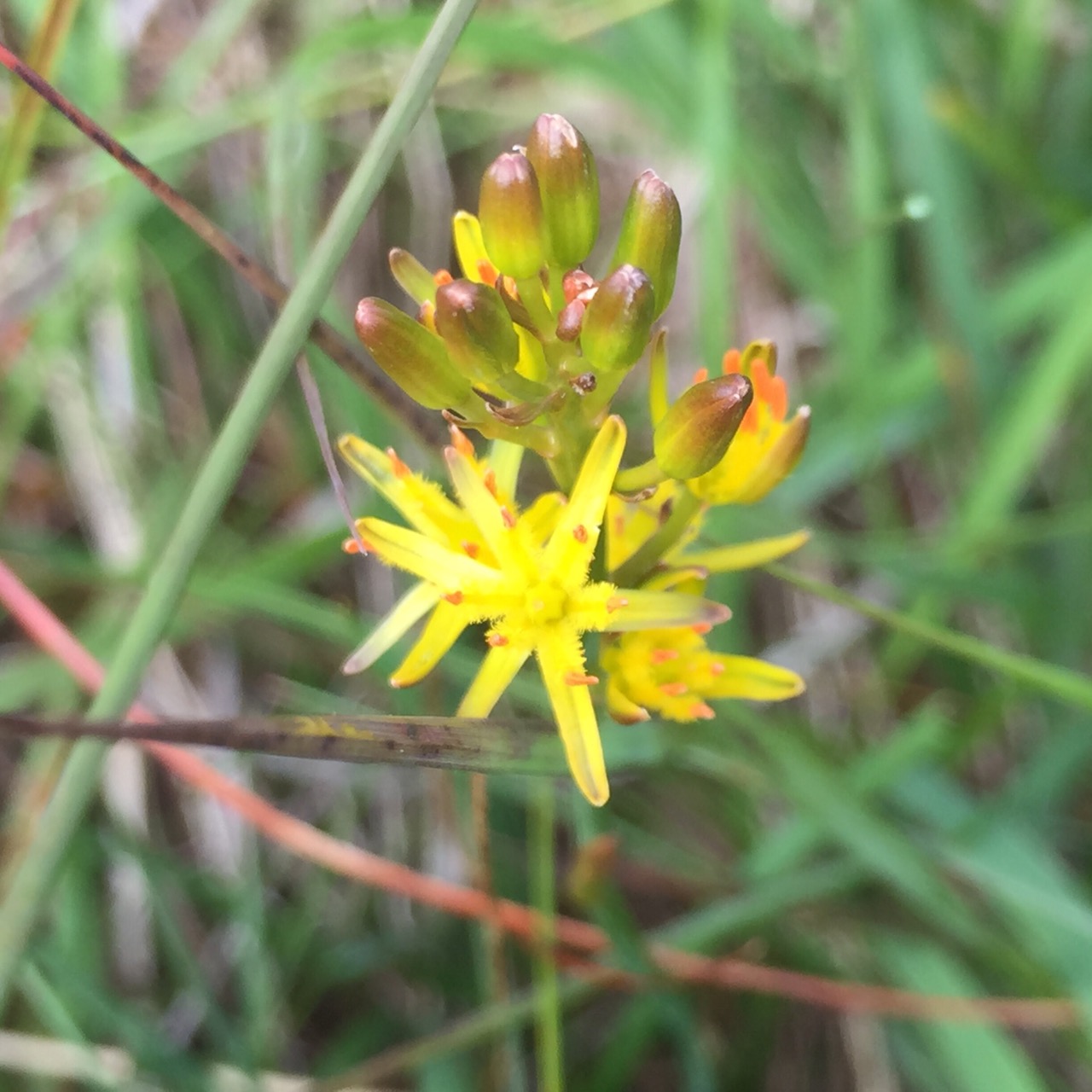
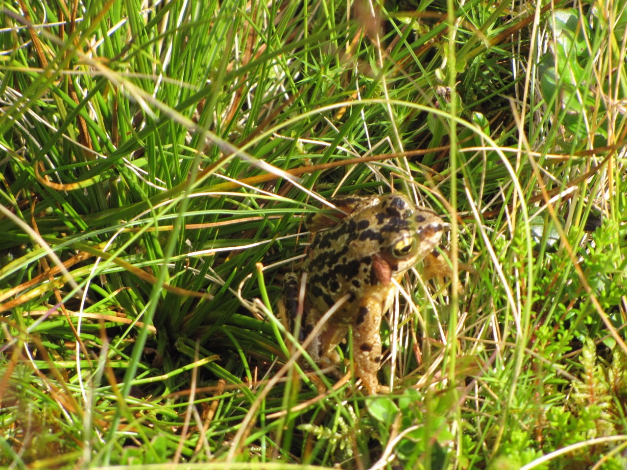
On Friday I was going for a walk and decided to try a few different ways of recording the walk centred around the iPhone.
As usual I recorded a gpx file and took some photos with the phone for A Mapped Walk
I also took other pictures with my camera and geotagged them once I got home with gpicsyncsuggested by Dan Stucke in a comment here. gpicsync is a visual front end to exiftool that I’ve mentioned before and works well, unfortunately my iPhone battery gave up early as I was using lots of apps, but a few were mapped by Flickr. The rest taken on the way bak down are untagged.
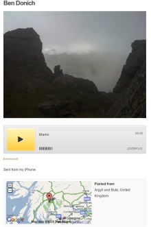
At the top of the hill i decided to try audioBoo. I love the way Audioboo combines a picture, the audio and a wee map and is simple to use. Unfortunately I didn’t have a good enough signal to post the boo from the hill.
Instead I turned to posterous. The really good thing about posterous on the iphone is that because it used email you don’t need a signal, the mail app will just wait until it gets one and sends the mail. I found this out on my holiday this year when I seemed to get an occasional signal overnight, making posterous the easiest way to blog. I’ve also found out how to combine images and audio in an email from the iPhone and because posterous now geo locates your post if there is a location in the exif data of any images posted you get the same effect as audioboo. See Ben Donich – John’s posterous.
The trick is, take a photo, switch to the camera roll and click the share/mail icon. choose the picture and copy it (This will work with several images). Then open up the Voice memos app, recods some audio and then mail it. You can paste the image(s) into your mail and send.
The last thing I tried was the lifecasting app iTunes url, this allows you to choose some photos and then record a narration over a slideshow of the images. The result can be uploaded to youtube or downloaded to your desktop as a m4v file (the app like many others acts like a wee server and puts up a webpage with the movies to download.)
Lifecasting works fairly well, the fact you cannot mail the file is a pity. The other problem is that the slides are shown for a fixed length of time, the example below is the longest, so you have to fit your audio to the show. I did duplicate a couple of images to give myself longer to talk. If the slides could be set to last the length of the audio and you could use mail or the metaweblogAPI to upload them this would be a great app for mobile learning.
lifecasting Example
I’ve downloaded a couple of other slideshow apps to investigate (at the vast expense of 59 pence each and will try them out whenever I can find them and have a bit of time).
Them ore I use my iPhone the more I believe that a device of this sort has a real place in the classroom for creating the sort of thing I used to use digital cameras, videos, imovie, garage bands and a blog for; the types of activity listed by Margaret Vass in her recent post on Learning, Teaching and ICT » Digital Storytelling ….. and ePortfolios?. We might need to wait a wee while the the right combination of price and feature set but it is getting more interesting every week.
This audio file was orginally posted to AudioBoo(m) with the mobile app. It has been downloaded and posted here since audioboom no longer supports free accounts.
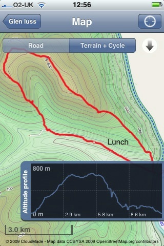
Since my last walk map post I’ve made a bit of progress. I am now using Trails an iPhone app that:
allows you to record, import and export tracks onto your iPhone.
Trails is really nice, it records and show position and altitude. It also allows you to cache map tiles when you have a good connection to use later on a walk. You can zoom in quite close and it has already been handy in finding out I was going the wrong way in the mist.
Trails allows you to email a track in both kml and gpx format. Clicking the kml file opens the trail in GoogleEarth.
I’ve been using GPSPhotoLinker a free app to add geotags to photos using the gpx track from Trails. Once you have dome that they will be mapped by flickr.
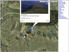
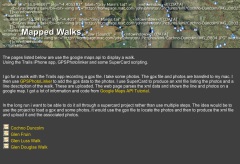
I’ve then been using .SuperCard to read the data from the photos and the gpx track and produce an xml file and set of resized photos. The xml files can be used with the google maps api to show the track and photos on a google map.
I’ve started to put together some webpages to list and show the maps: Mapped Walks.
The idea is to end up with a SuperCard project that cuts out some of the steps, it would take in photos and gpx file and upload resized photos and xml file to the web. I just need a bit of time to write and test the scripts.
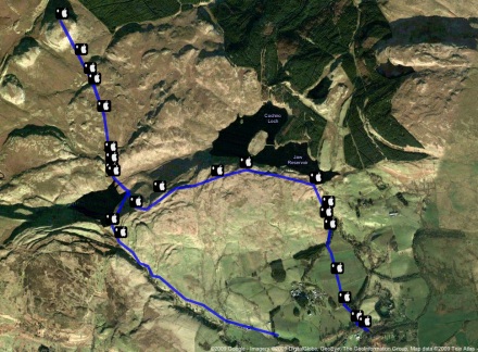
I have managed to add an mp3 player to some of the google bubbles on one map that plays sound recorded on my phone. The aim is to have pictures, audio video and text. The maps now also have links in the bubbles that take you from one to the next in the correct order, I think this could be come an interesting way to tell a story that travels through space and time.
I decided to try a new approach to plotting photos on a map today and use EveryTrail which according to the site:
With this geotracking application, you can record your movements, take geotagged photos, make notes and immediately upload it all to EveryTrail, the leading online community for travel storytelling
The weather was not very nice so i just went a short way from home to the Kilpatrick hills. I started walking and took some photos with EveryTrails as I went, it seemed a smooth and well crafted application. After about 20 minutes I decided I could not remember if I had locked the car to turned around to check. I clicked stop and save in the app and as I was looking at the field to fill in the application quit. On opening it nothing was saved.
On restarting the walk I reverted to using SnailTrail (this application seems to have vanished from the store.)
SnailTrail just lets you save a list of waypoints and email them to yourself. I sure a simple SuperCard project to create the kml file from the list and the photos exif data. I’ve uploaded the the kml file which will open in google earth and imported it into google maps.
I noticed a strange thing when working with the photos, the ones taken in portrait seemed to have lost their exif data. I drag the photos from iPhoto onto my SuperCard project to get the exif data (Via the exiftags commandline app), it seems when iPhoto rotates the images according to the camera’s instructions it loses the exif data. however if you export the files via iPhoto’s file menu you can check a box to include location and the exif data is in the exported files.
Update 2 March 2009 I was trying to incorporate mp3 sound in the kml file but the object tag is not shown by google maps (it is by earth) so I’ve experimented with the maps API and have markers with pictures and sound: Mapped walk which has some potential I think.
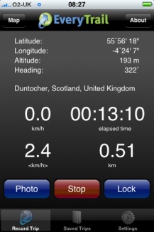
I had a very pleasant location experience this week. I had been trying the iPhone app Tracker to ftp a small webpage with my location to the web (example target=”new”), I was then parsing out the data with php to produce a static google map (example). Then the application was upgraded and the structure of the html file was improved, this of course broke my script. I then emailed the developer Stefan Welebny and asked him if he could have an option just to upload the basic information to a text file. Much to my surprise he wrote back and then updated the application. It now will send the information as parameters to a webpage, in my case a php file. at the moment my file just writes that information out to a text file but I hope to soon be able to record my location to a list and then do other things with it. As I understand it Tracker will send its position every 20 seconds so I could use it by turning the app on for a few seconds to record a location.